- Feb 17, 2013
- 414
- 488
Hello folks!
The number one mistake that new mappers make when mapping is to underscale or oversize their map in the first alpha, making sightlines ridiculously huge or doorways impossible to squeeze through. That's because Hammer has very little frame of reference - short of sticking some little men on the landscape or memorizing some hammer unit numbers for various well known locations.
BUT NOT ANY MORE!
I wanted to create an easy to parse guide to converting between hammer units and known locations. I know how long Badlands Bridge is in game, but what about in Hammer units? But arena space is something that people picked up easily, or could at least learn the numbers from Grazr's guide. That's why I also wanted my guide to teach mappers the sizes and positionings of the various lobbies and gateways to different parts of the map. In short, I wanted mappers to look at a picture and instantly know how far away two well known points were in Hammer Units. These are those pictures:
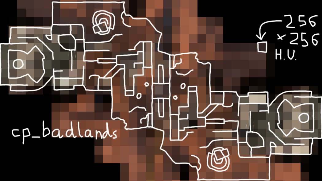
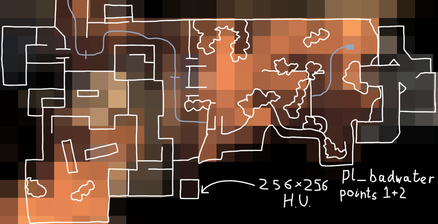
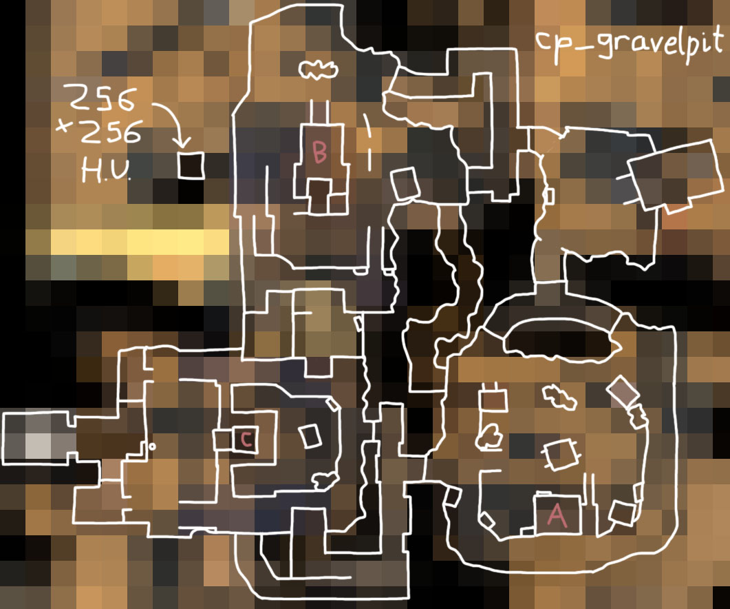
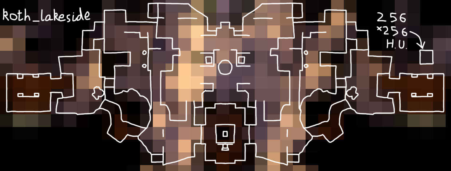
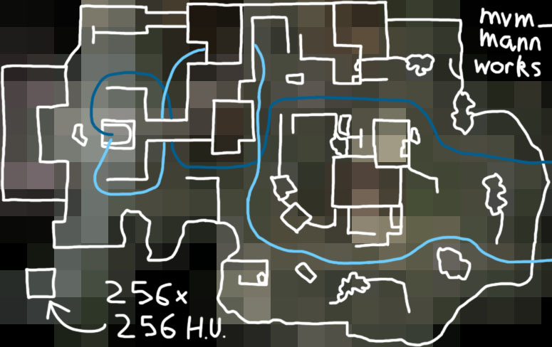
I would reccomend printing these out and sticking them on the wall if you are a serious mapper! I genuinely spent a stupid amount of time making these so I'd like some unconditional praise and clicking that thanks button. I shouldn't have done this.
The number one mistake that new mappers make when mapping is to underscale or oversize their map in the first alpha, making sightlines ridiculously huge or doorways impossible to squeeze through. That's because Hammer has very little frame of reference - short of sticking some little men on the landscape or memorizing some hammer unit numbers for various well known locations.
BUT NOT ANY MORE!
I wanted to create an easy to parse guide to converting between hammer units and known locations. I know how long Badlands Bridge is in game, but what about in Hammer units? But arena space is something that people picked up easily, or could at least learn the numbers from Grazr's guide. That's why I also wanted my guide to teach mappers the sizes and positionings of the various lobbies and gateways to different parts of the map. In short, I wanted mappers to look at a picture and instantly know how far away two well known points were in Hammer Units. These are those pictures:
I would reccomend printing these out and sticking them on the wall if you are a serious mapper! I genuinely spent a stupid amount of time making these so I'd like some unconditional praise and clicking that thanks button. I shouldn't have done this.
Last edited:


